Pages

Friday 4 December 2020

Taking Part in the Regent's Canal Bicentenary

17th October 2020

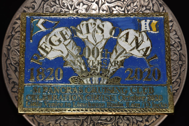
This is my first post in a while! In October, I had the privilege of attending the bicentenary celebration of the opening of the Regent's Canal. Eighteen barges from the St Pancras Cruising Club travelled from Browning's Pool in Little Venice to Limehouse Basin to mark the occasion, commemorating an elaborate procession of boats and brass bands led by the Earl of Macclesfield, that took place in August 1820. In July, I had also taken part in a podcast for the London Design Festival to commemorate the bicentenary, where I gave a short tour of the stretch between Angel and Haggerston.

I feel very lucky to have a personal connection with the Canal: I was born at St Mary's Hospital, which faces Paddington Basin, and frequently visited family in the area when I was little, so Little Venice was a very familiar sight. This time, it was fabulous to see the area through a different angle, noticing just how much biodiversity can be found there!

Browning's Pool, Little Venice

Rembrandt Gardens, Little Venice, which has won a green flag award

Designed by John Nash, Thomas Homer and James Morgan, the Canal is situated entirely in the Historic County of Middlesex, and its original purpose was to transport goods such as coal and timber by boat, with horses carrying out a similar job on the towpaths. Over time, the industrial landscape fell into disuse, with the last horse-drawn commercial journey taking place in 1956, and boats stopped transporting cargo in the 1960s. From then, the purpose of the Canal gradually evolved into one that puts people first: the towpaths were redesigned, and as people became more passionate about the Regent's Canal, many community groups and organisations were set up, making the Canal what it is today. Many aquatic plants were planted over time, attracting birds, mammals, fish and invertebrates, and several green spaces surrounding the Canal have become nature reserves and designated Sites of Importance for Nature Conservation.

Now, the Regent's Canal is a place where people and nature have the potential to thrive together. Some of the star species to see are Kingfishers; Cormorants; House Sparrows, the 'Cockney sparra', whose population is in severe decline; Emperor Dragonflies; Seals nearer to Limehouse Basin; Mute Swans; the odd Yellow-bellied and Red-eared Terrapins; and Coots, which are some of the most resilient birds in the capital, learning to use just about anything to build their nests.

Red-eared Terrapin, Kingsland Basin, July 2020

'Cockney sparra', Kingsland Basin, July 2020

A coot nest often contains more than just leaves and twigs, Barnsbury, June 2019


The Canal and River Trust work closely with the volunteer groups that manage different stretches of the Canal, and as part of the celebrations, two sites were given green flag awards to recognise their conservation work: Kingsland Basin, a fantastic nature reserve in Hackney run by the Wildlife Gardeners of Haggerston; and the Lower Regent's Canal.

Kingsland Basin received a green flag award for its conservation efforts, as part of the bicentenary

That day, I was being interviewed by Lucy Greenwood from the Trust, sharing my thoughts on the history of the Canal, what wildlife can be found there, how people can get involved when they visit, and my vision for the next two hundred years.

Being interviewed by Lucy Greenwood, Canal and River Trust

The interview took place at Macclesfield Bridge, just outside Regent's Park, in a most beautiful, countryside-like stretch of the Canal. The dense foliage was starting to show its autumnal colours, and a Kestrel darted overhead; a stark contrast to the towering 19th Century footbridges that spanned the waterway, reminding me how much the Canal has transformed over the past two centuries.

The bridge's nickname, 'Blow-up Bridge', comes from a notable incident in 1874, when a boat named The Tilbury approached the bridge, carrying gunpowder. Gunpowder was too dangerous to carry on the railway, so the only option was to transport it by boat. As The Tilbury passed under the bridge, it exploded, killing three men and a horse, and Lucy informed me that the adjacent Plane Tree has been scarred from the explosion!

One of the boats taking part in the flotilla


A commemorative plaque from the celebration: the three ostrich feathers and motto of the Prince of Wales can be seen in the background, as the canal was built for the Prince Regent, then Prince of Wales

It has been an honour to be involved in this memorable celebration of the Canal, and learn so much about its biodiversity and history. I hope that the next two hundred years will see more exciting stages of evolution in the Canal's history, to benefit both people and wildlife.

Monday 20 July 2020

First Visit to Warren Farm, Ealing

31st May 2020
Nearly two months ago, I visited a hidden jewel of Ealing, a vast area of fields, scrubland and meadow called Warren Farm. I had been involved in a campaign for some time to save it from development by Ealing Council, who plan to turn the Farm into a landfill site, and car parking, despite the fact that it has several red-listed species. Many wildlife enthusiasts have spoken out against the development, and the campaign has been spearheaded by Hanwell Nature, a wonderful group of local conservationists.

The Farm is near the edge of the Brent River Park, a huge collection of SINCs and green spaces that stretches from Pitshanger Park on the busy A40, through Perivale Park, Brent Valley Golf Course, Brent Lodge Park including Hanwell Zoo (known to many including myself as the 'Bunny Park'), Elthorne Waterside, Warren Farm, Long Wood LNR and ending at Boston Manor Park in Hounslow. 

My mum, brother and I parked outside The Green Pub in the picturesque Ealing suburb of Hanwell, and walked to an entrance to this vast conurbation of habitats, and the mighty Grand Union Canal. Here, we met a local campaigner and naturalist Peter Edwards (he is incredibly knowledgeable: he knows everything about the borough's biodiversity!), and Katie Boyles, another brilliant conservationist who I had been corresponding with frequently, and she had initially introduced me to the Farm last year. Katie and Peter guided us past the Canal's confluence with Park's lifeblood, the River Brent, and to a gate, which gave visitors the first taste to a different world ahead of them. My first view of Warren Farm was quite surreal: the sixty-one acres of acid grassland meadow seem to stretch for miles, with at least five raptor species flying gracefully above. The sheer scale of the diversity of plants seemed endless, Dunnocks chattered noisily beside the Brent, and overlooking the farm was a cluster of tall trees, which are regarded as the symbol of Warren Farm.

We walked along the grass path that surrounds the meadow, while Katie and Peter informed us of the history of the land, and the species see at this time of year. My mum found some Oak Processionary Moth caterpillars on the edge of the Farm, and we kept our distance from them so we did not inhale their hairs! We were soon joined by the excellent wildlife photographer Wayne Hoeftmann, who has also campaigned against development on the site. Eventually, we reached a brownfield site, a former sports centre, opposite fields owned by the Earl of Jersey. Here, Wayne explained that the site has regular Blackcaps and Wheatears each winter, and Peter mentioned that a few uncommon species of plant now inhabit the site, and potentially Black Redstart too.


Reservoirs beside the River Brent

Small Skipper(?)

Oak Processionary Moth caterpillars

Cinnabar Moth

Mistle Thrush

Buzzard

The Farm's brownfield site


We walked from the brownfield site, on the path opposite the border with Hounslow. From here, many of West London's landmarks could be seen, including the GSK building, the former Gilette factory, Wembley Stadium, Harrow-on-the-Hill and many areas of Ealing, emphasising how ecologically important Warren Farm is for such a large area. As we admired the skyline, the Farm's star species ascended from the dense grassland into the air, singing its heart out- the Skylark.

Due to severe habitat loss in West London, this iconic songster has largely vanished as a breeding bird from Ealing and Hillingdon, with the exception of a few grassland and meadow strongholds such as Yeading Brook Meadows and indeed Warren Farm. It was very emotional to witness a Skylark so close to home, but heartbreaking to think that its habitat is planned to be mercilessly destroyed by an ignorant minority of people. It danced elegantly in the air, before diving back down into the fields in front of us. Two birds repeated this elegant dance for five minutes, and it was definitely an unforgettable sight.

A Skylark signs and dances in the air


Skylark


We all continued to share our experiences of wildlife in the area, and Katie and I discussed how to continue the campaign to fight for Warren Farm, now that the site has been granted judicial review. At 6:30pm, we had arrived back at the famous cluster of tall trees, signalling our completion of the loop around the Farm. It had been such a magical experience, finally visiting this immensely valuable haven for Ealing's biodiversity. Hanwell Nature are continuing to campaign for its protection, and I am looking forward to visit the site again over the summer.

Male House Sparrow

A local landmark- the cluster of tall trees are a symbol of Warren Farm

I encourage you to come to Warren Farm and see this paradise for itself- believe me, your first visit will be magical.

Saturday 6 June 2020

London Area Profile II: Barnsbury, Islington

27th May 2020
Today's area profile will be about a small locality in the London Borough of Islington, and one of my favourite. Barnsbury is an affluent area near King's Cross, and straddles the ecological wonder of the Regent's Canal. I first visited Barnsbury in July 2019, after a great trip to a few gardens on Open Garden Squares Weekend: after seeing the innovative Skip Garden (read about it here), I was eager to explore what lay further down the Canal. 

The area has a few designated wildlife sites: Bingfield Park, Barnsbury Wood LNR, Thornhill Square and Barnsbury Square. Out of these four, I have only visited Thornhill Square. This lies in the middle of a small residential area, and is adjacent to St Andrew's Church, consecrated in 1854. It consists of a small playground, surrounded by Horse Chestnuts and London Planes, and has a variety of manicured flower displays: nonetheless, they attract many bees and butterflies (I have seen Red Admiral and Small Tortoiseshell here). There are many shrubs around its perimeter, encouraging Blackbirds, Blue Tits, Dunnocks, Goldfinches and other common bird species. This is the same at Bingfield Park, despite lacking tree cover, and Barnsbury Square. The latter has almost a woodland-like character, and interestingly, lies on the site of an ancient camp used by a Roman general, who defeated Boudicca in 61 AD: when the park was being designed, Roman arrowheads were found here.

Barnsbury Wood lies near to Thornhill Square, and is usually open on Tuesdays. It is a small Local Nature Reserve, and the second smallest in London, after Burnt Ash Pond in Lewisham. The reserve is used for education purposes, encouraging the local primary schools to use the space on weekdays, which is marvellous! I have only stood outside the entrance as it was closed the day I visited Barnsbury, but according to Islington Council's website, the LNR is home to Long-tailed Tit, Toad, Sixteen-spot Ladybird and the rare Lesser Stag Beetle. There are a few other green spaces in Barnsbury, such as Barnard Park and Caledonian Park.


The entrance to Barnsbury Wood LNR- it looks almost like the door to a secret garden


A Coot on its nest

Canada Geese in flight

A beautiful mural of the fish of the Regent's Canal;

the birds of the Canal;

and its invertebrates, at Thornhill Bridge Community Garden, created by a local initiative, Cally Arts

Squirrel

Black-headed Gull

Coot

Blackbird at Thornhill Square

Thornhill Square

The area has a diverse history, starting in the 13th Century, when a swathe of modern-day Islington was owned by the powerful Berners family. The family were granted the land after the Norman Conquest, and gave their name to what is now Barnsbury (the original name Bernersbury was recorded in 1274). By the early 19th Century, development had only just begun, due to legal obstacles. The area became the first stop for travellers to rest on the journey from London to the North of England, and there was often a considerably large amount of agricultural goods and livestock passing through, due to its close proximity to Smithfield Market. Barnsbury was strong in its local trade, and became popular with the upper class, who desperately wanted to escape the industrial and polluted City of London, Spitalfields and Clerkenwell. Around this time, the King's Cross to Limehouse stretch of the Regent's Canal was being built, leading to the creation of Horsfall Basin, named after its first landowner, and its wharf buildings were completed in 1822 (today this is Battlebridge Basin). In the late 19th and early 20th Centuries these buildings were used to store ice from Norway. 

In the 1830s and 40s this semi-rural suburb evolved into Frenchman Henri Baume's short-lived Barnsbury Park Community, a project which urbanised the area and aimed to bring its people together. The project set up a farm and a college, maintained by enthusiastic shoemakers and tailors. The Holy Trinity Church was built around the same time, by the architect who designed the Houses of Parliament, Sir Charles Barry. In the 1840s, Barnsbury Wood was the garden of George Thornhill, MP for Huntingdon, who built the surrounding houses.

When the Industrial Revolution began in the early Victorian era,  Barnsbury's affluent residents quickly moved out, as it was encroached by terraced houses for factory workers, and some larger houses became factories themselves. These terraced houses make up most of Barnsbury today. In 1826, Caledonian Road (or 'The Cally' as residents call it) was built, named after the Royal Caledonian Asylum, which is still a charity today. The Road was situated in Copenhagen Fields, which is now the Caledonian Clock Tower and its surrounding parks. In 1842, HMP Pentonville was built on the Barnsbury part of the road.


Map of Barnsbury, 1868. Credit: MAPCO 

Barnsbury is sometimes seen as one of the pioneers of post-war gentrification. In the 1960s, the area became more appealing to the middle class, when run-down houses were demolished and replaced by the Barnsbury Housing Association, formed in 1967. They also restored the interiors some of the late Georgian and early Victorian terraced houses, some of which had retained their characteristic facades, a reason why passers-by assumed that a redevelopment was not needed. As a result, house prices shot up.

Today, the majority of the terraced houses are intact and retain their splendour. There is also a large council estate, the Barnsbury Estate, and the area is served by the Piccadilly Line's Caledonian Road Underground Station, and Caledonian Road & Barnsbury Overground Station. The latter replaced an older station nearby and was opened in 1870, while the former (actually in Lower Holloway) was opened in 1906 by the Great Northern, Piccadilly and Brompton Railway, built with oxblood tiles by Leslie Green. Battlebridge Basin, named after an ancient crossing over the subterranean River Fleet, is now home to the London Canal Museum, which was constructed from one of the old ice storage buildings from the 19th Century: two of its ice wells can be seen today. The Museum covers all aspects of the UK's canals, and runs guided tours through the Islington Tunnel and surrounding area.

Barnsbury's boundaries used to be the Thornhill ward, named after the MP who built its houses, but today this consists of Islington's Caledonian and Barnsbury wards.


The old wharf buildings and the London Canal Museum at Battlebridge Basin

Converted wharf buildings at Battlebridge Basin

Victorian houses near Barnsbury Wood, designed by George Thornhill MP

An 'energy garden' at Caledonian Road & Barnsbury Station

The beginning of Caledonian Road high street

The Regent's Canal, Barnsbury, from Thornhill Bridge

A residential street, with what appears to be a former industrial building in the background

Whenever I have visited this hidden gem of Islington, seeing the historic facades of the houses and the old Victorian parks never fails to surprise me. Of course, its beautiful green spaces will certainly show a visitor that the capital's habitats are diverse, even when close to central London.

Sources: Wikipedia, Hidden London, GiGL, City AM, Barnsbury Housing Association


Monday 4 May 2020

London Area Profile I: Eastcote, Hillingdon

27th April 2020
As we are confined to our homes during these uncertain times, the best way to make the most of it is by enjoying our local area, our doorstep and its wildlife. This has made me reflect even more on my immediate surroundings, including my own area, as well as others I have visited around London. This is the first post in a series of musings and reflections on my visits to some of the capital's fascinating neighbourhoods. This first profile is about my town, Eastcote, in the London Borough of Hillingdon.

Starting off with its wildlife, I will not be including species I have seen in my garden! There are several SINCs within Eastcote: Haydon Hall Meadows, Pinn Meadows, The River Pinn, High Grove and a section of the Yeading Brook. Other green spaces include Eastcote House Gardens, Field End Recreation Ground and a few war memorials. The Recreation Ground is home to Blackcaps, Chiffchaffs and Willow Warbler, and common species such as Greenfinch and Dunnock, with the very occasional Woodcock flying over, presumably from Ruislip Woods, where there is a small population. Eastcote House Gardens has Little Egret along the Pinn, Song and Mistle Thrushes, Nuthatches and the warbler species mentioned before. In May, I heard a Reed Warbler there! Red Kites, Buzzards, Sparrowhawks and Kestrels can often be seen flying over the town centre, and in winter, the railsides and berry bushes around the station have a large population of Redwing and Fieldfare. In summer, Swifts and Swallows nest in the lofts and eaves of houses, on roads with a lack of trees; these are few and far between, as Eastcote is a very leafy, green suburb. There are many Fox territories across the area too, but an absence of reptiles. The range of trees on Eastcote's streets is diverse, and I have been able to identify many using the fantastic TreeTalk app. The app has helped me find a rare Black Mulberry in a council estate, of which there are fewer than ten on the streets of London!

Jay


A Little Egret crossing the River Pinn


Fox


Redwing at Eastcote Station


A very, very rare Black Mulberry in a council estate!

Now onto the area's history. Eastcote is situated near to Pinner and Rayners Lane in the London Borough of Harrow, and adjacent to Ruislip and Northwood. The town's name derives from a Medieval parish known as Ascot, with modern-day Eastcote lying in the east of the parish (the local pub, The Ascott, gets its name from this). Unfortunately nothing historic has happened here, apart from at Eastcote House Gardens, where the affluent Hawtrey family, with connections to Charles I lived. The family constructed the Grade II* listed Walled Garden there, and near Warrender Park, Highgrove House became residence to a number of famous people during the early 20th Century, including Sir Winston Churchill and Victoria, Queen Consort of Sweden. In total there were three stately homes of Eastcote: Eastcote House, demolished in 1964; Haydon Hall (built for Alice, Dowager Countess of Derby), demolished in 1967; and the Grade II* listed Highgrove House. Bletchley Park set up RAF Eastcote during World War II, and GCHQ brought two Colossus decoding machines there until the organisation moved its headquarters to Cheltenham. This outpost has been demolished as well.

The Ruislip Enclosure Act of 1804 subdivided Eastcote's farmland with hedgerows, which would have been essential habitats for wildlife. This act created a twenty-foot bridleway, now known as Bridle Road: walking down it most days, I imagine that once, the hedgerows and foliage that existed beside it would have been alive with birdsong. In the 1920s, the farmland was destroyed by the dominating Metroland scheme, connecting the area to central London and making way for many tea rooms, semi-detached houses and the Eastcote Park Estate.

Map of Eastcote, 1897 (credit: Wealden Relics/eBay)

Entrance to the Grade II listed Walled Garden, Eastcote House Gardens

The Walled Garden

The dovecote


A Tawny Owl nestbox, Eastcote House Gardens


The Celandine Route, which connects many SINCs and green spaces along the Pinn

Warrender Park (credit: Eastcote local)

Highgrove House, the last of the three Houses of Eastcote (credit: Wikimedia Commons)

Eastcote town centre, with its new 'rain gardens' (credit: London Borough of Hillingdon)

The area is mainly residential, and the small locality of Eastcote Village is bordered by my patch, Ruislip Woods National Nature Reserve. The town centre, situated on Field End Road has recently been redeveloped, with many SuDS (Sustainable Drainage Systems), each with a variety of wildflowers: Goldfinches and many Pied Wagtails can be seen here. Eastcote Station is served by the Metropolitan and Piccadilly lines, making the commute to central London less than half an hour.


Eastcote Underground Station (Credit: Wikimedia Commons)

Visiting so many places across London has almost made me forget about the amazing wildlife in my own local green spaces, and this lockdown has taught me to explore what Eastcote has to offer: I am already surprised!